|
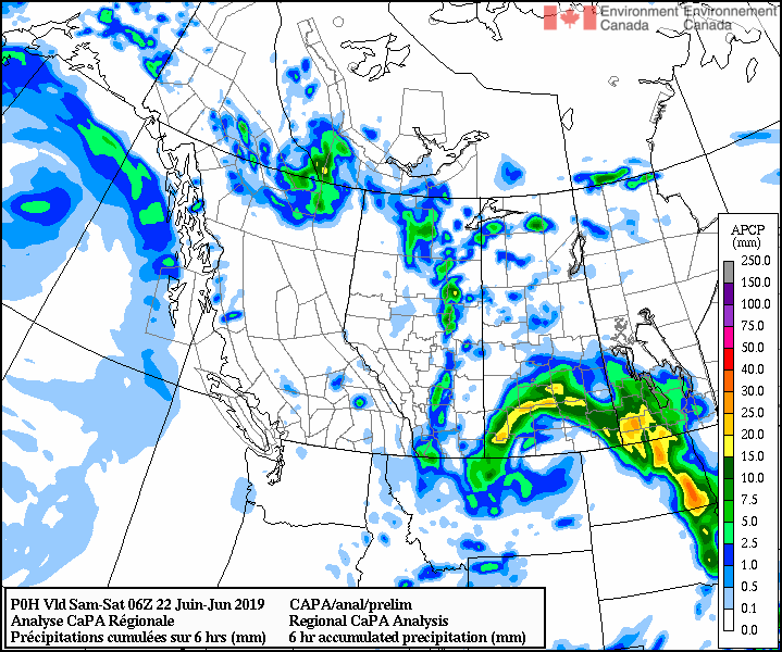
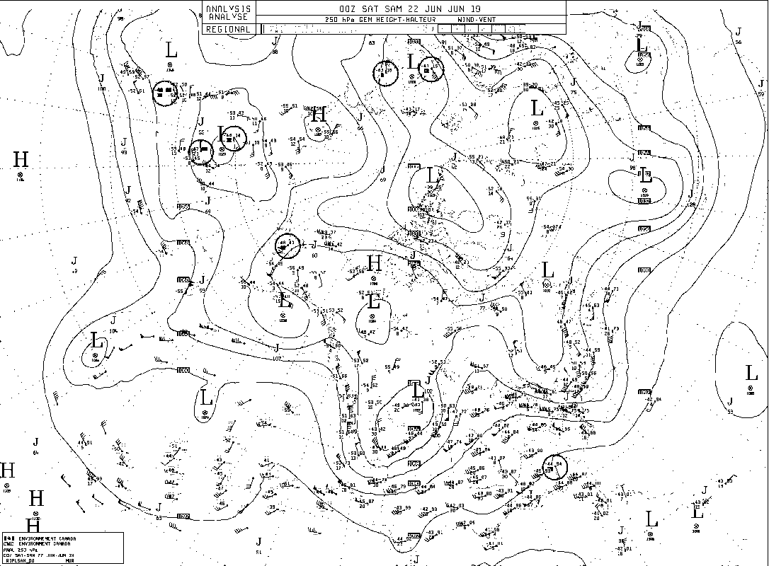
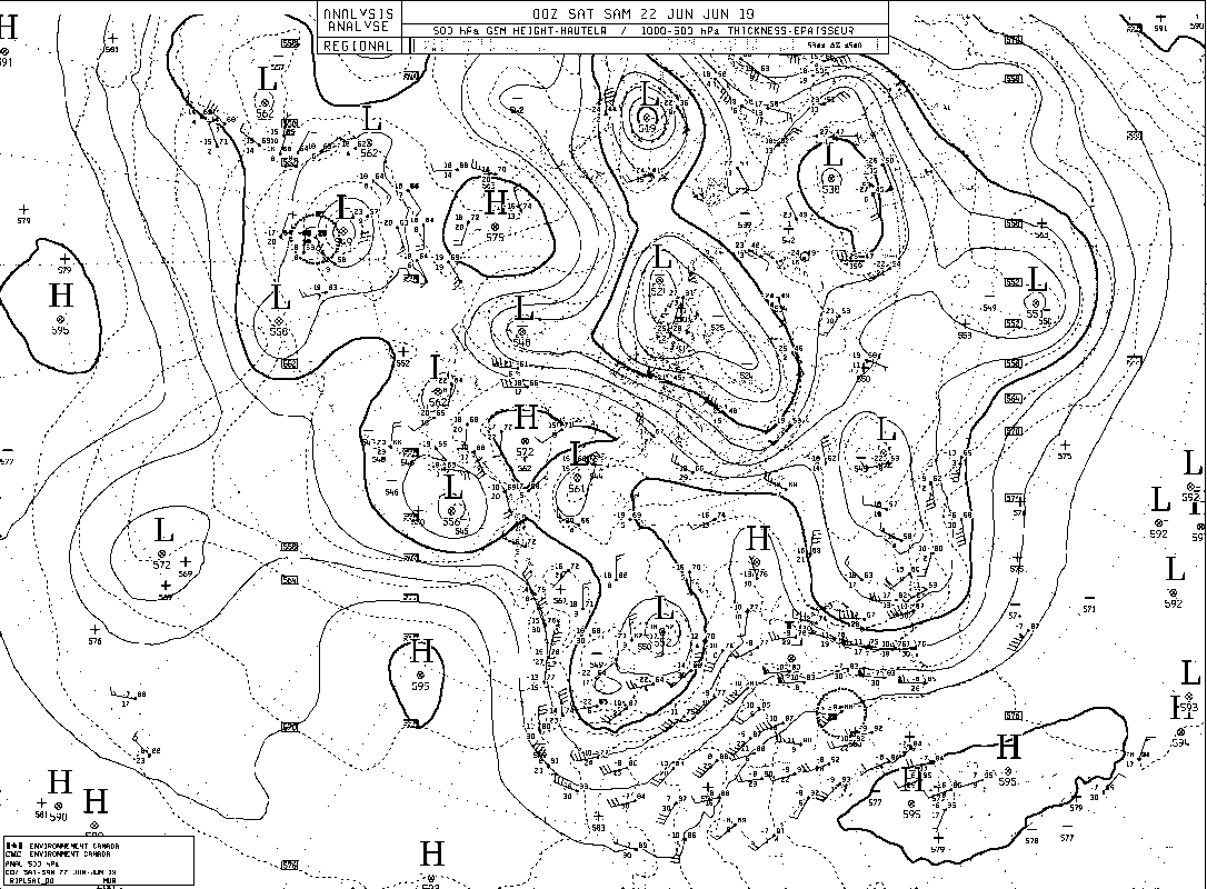
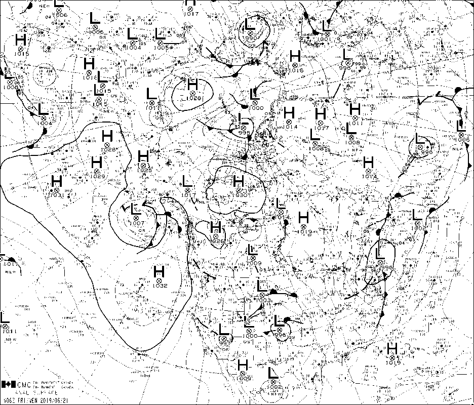
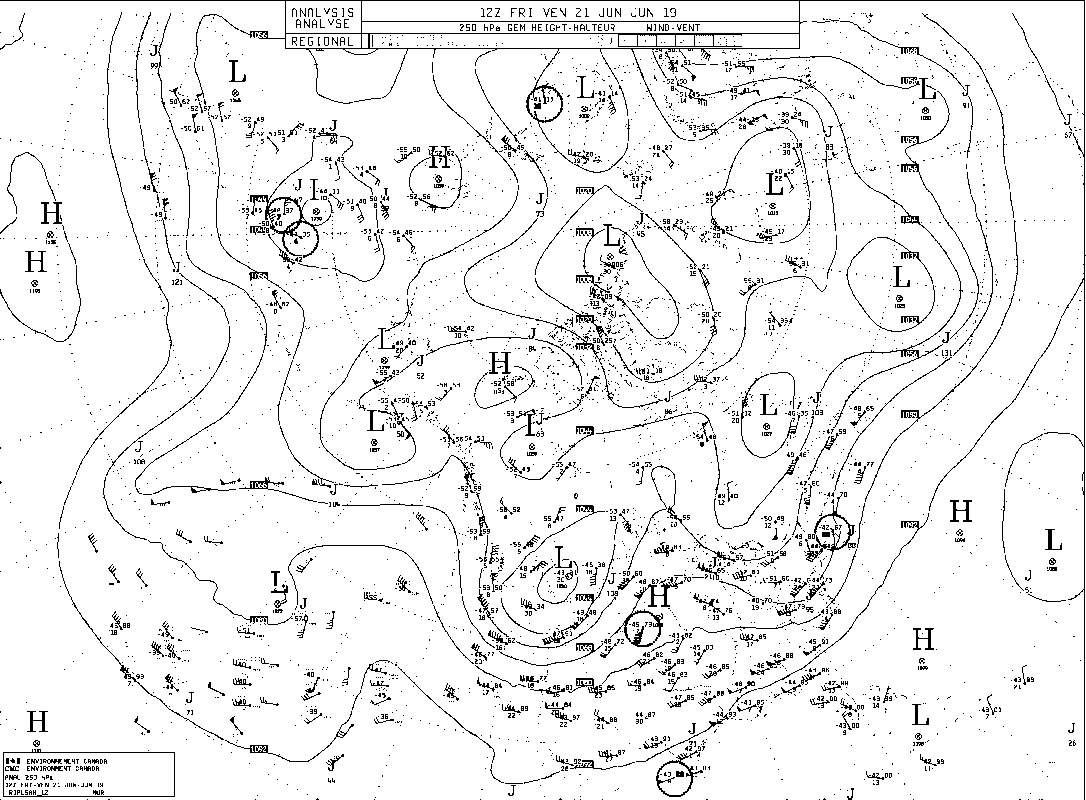
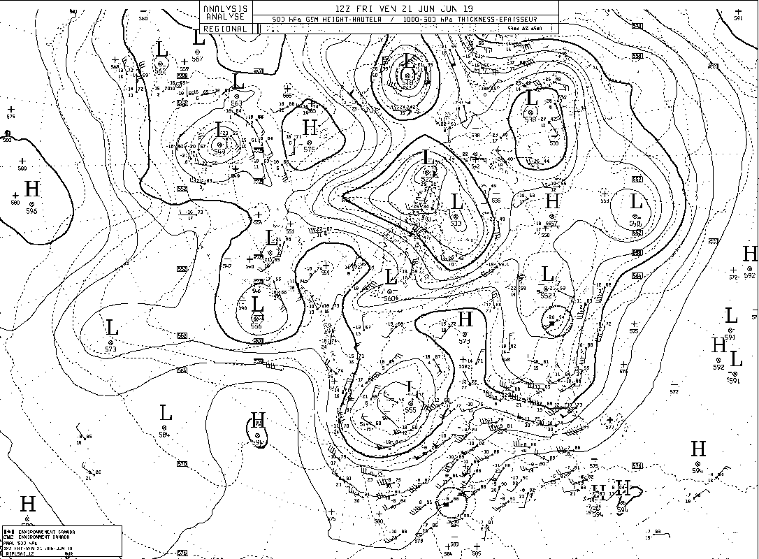
FORECASTER: Charlie Hébert-Pinard SYNOPTIC OVERVIEW: Again, it's really similar to yesterday. Low pressure and upper low over the MB/SK border and a small low pressure over the Pacific on BC coast. Nothing that will affect us today. In our studied area, there's a surface trough south of Calgary and the 250mb jet will help lifting. The RH is reasonably high for BC and AB. All these conditions will allow convection and some sub-severe thunderstorm to develop.
0 Comments
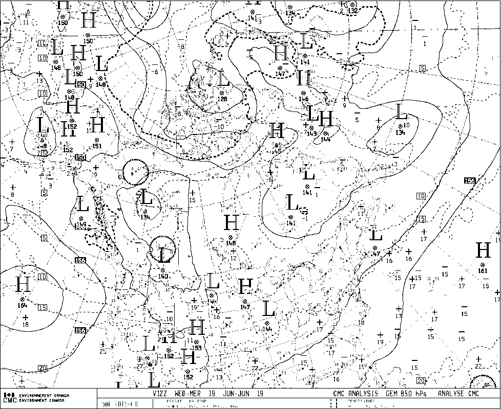
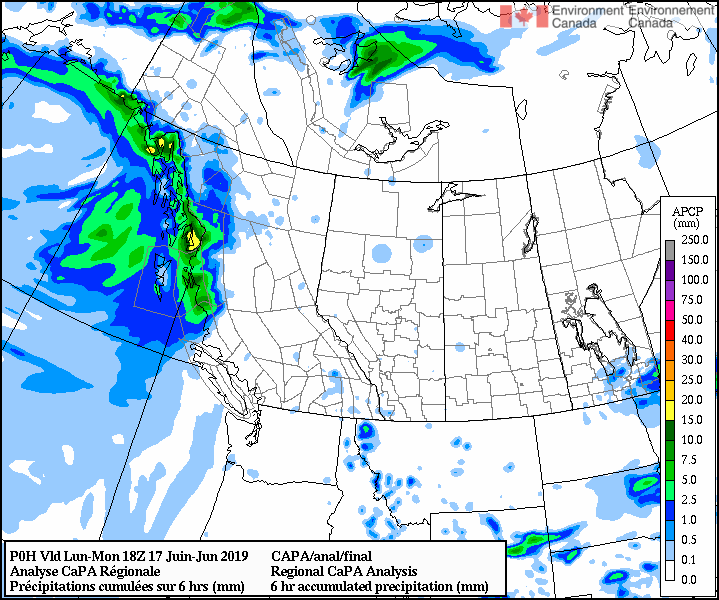
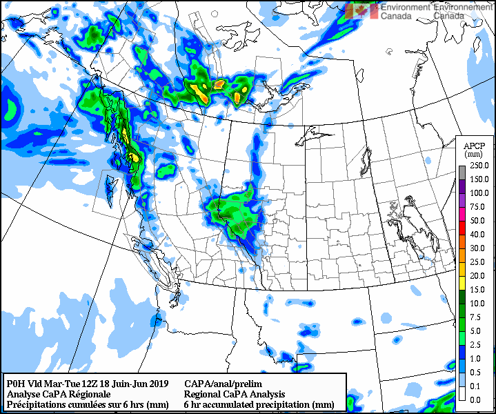
FORECASTER: Juris Almonte SYNOPTIC OVERVIEW: Similar to yesterday's forecast, no major system is affecting the SPADE region today. However there is potential for convective storms over the foothills today. The surface charts (1200 UTC) show a low pressure system (1000 hPa) midway up the over the border of SK and MB. A strong high pressure system (1032 hPa) on the coast of the US Pacific northwest and a weak low pressure system (1013 hPa) over northern BC.
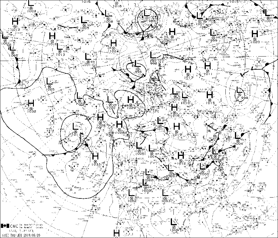
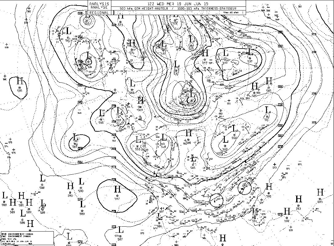
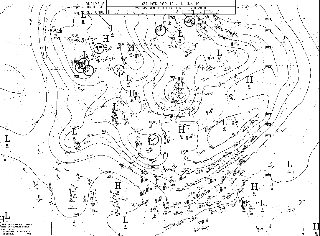
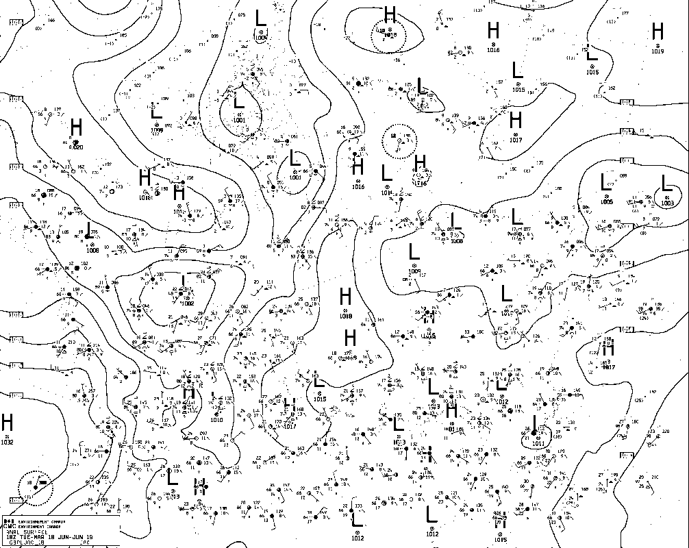
Forecaster: Stephen Déry Synoptic overview: There is no major system affecting the Rockies this morning with a weak high pressure system (1021 hPa) residing over Jasper National Park and a weak low pressure system (1015 hPa) in southern BC. The main synoptic feature that affected the Rockies over the past couple of days has shifted very slowly eastward and the low pressure centre (1002 hPa) currently lies on the Saskatchewan/Montana border. It is a vertically stacked low pressure with corresponding upper level lows at 500 and even 250 hPa, suggesting the low is no longer intensifying and will continue a slow progress northeastward. The flow aloft will be from the north and will advect cold air in the mid-levels of the atmosphere leading to instability as the surface gradually warms today. In the short- to medium-term an elongated upper level trough will continue to influence our study area inducing possible weak convection later in the day. Nipika GEM2.5 Partly cloudy conditions with a slight (40%) chance of showers today mainly in the afternoon with the risk of a thunderstorm around 4 pm. The model suggests an accumulation of 5.6 mm over one hour, perhaps due to a passing storm (CAPE values ~800 J/kg). Temperatures will warm to 18°C by the afternoon. Clearing thereafter and possibility of scattered showers on Sunday with total accumulation of ~1.5 mm. GEM10 predicts similar conditions but with more abundant precipitation starting around 1 am MDT on Sunday for a total daily accumulation of 10 mm with precipitation ending near 3 pm. HRRR minimal precipitation today 1.3 mm starting at 1 pm NAM resembles GEM10 with overnight precipitation totaling ~10 mm. Fortress Mountain GEM2.5 Convective instability will affect Fortress today with scattered showers starting around noon. Total precipitation during the day is ~4 mm in liquid form. Temperatures will peak at ~12°C. Similar conditions will prevail on Sunday with possibly another 4 mm or precipitation around 3 pm. GEM10 Minimal precipitation today ~1 mm with slightly higher amount Sunday starting around noon (4 mm). HRRR is dry at Fortress for this forecast cycle. NAM is wet, suggests precipitation starting ~8 pm Saturday until noon Sunday with total accumulation 13 mm (all liquid). Storm Mountain Lodge GEM2.5 Similar conditions to the other sites with clouds and convective precipitation starting mid-day with total accumulation (all liquid) of 2 mm both today and tomorrow. Maximum temperature will reach 20°C. FORCASTER: Hilary Smith SYNOPTIC OVERVIEW The low pressure that was located over central AB is tracking eastward and is now on the border of AB and SK. Rainfall amounts will likely decrease throughout the day, starting in northern AB. According to the ECCC weather discussion, "wrap around" moisture from the low located over Montana will result in heavy precipitation over the southern Rockies. Rainfall warnings are still in effect for the Kananaskis-Canmore area and are expected to end in the evening. The Bow Valley region could see rainfall amounts exceeding 100 mm.
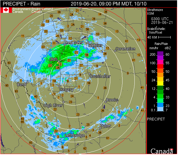
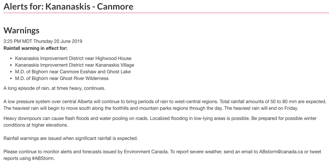
FORECASTER: Hilary Smith SYNOPTIC OVERVIEW Current radar images (9 pm MDT) show substantial precipitation moving towards Fortress Mountain. There is a low pressure system located in central Alberta which is affecting the SPADE region and bringing significant precipitation into the area. According to ECCC weather analysis, there will be an unstable airmass located over the east Kootenays Friday, and the bulk of the precipitation will occur on the eastern Rockies. Moderate rain and snow is expected on the western side of Rockies. There is currently a rainfall warning in effect for Kananaskis-Canmore due to sustained rainfall which may become heavy at times. Total rainfall amounts of 50 - 80 mm are expected, and winter conditions may occur at higher elevations. The heaviest rain is expected to end on Friday.
FORECASTERS: Juris Almonte & Hilary Smith SYNOPTIC OVERVIEW There is a low pressure located on the border of Alberta and Saskatchewan that is affecting the SPADE region. According to the ECCC weather discussion, this low pressure system will give a long duration rainfall event for the SPADE area. It is expected that the upper low will be over southern Alberta Thursday morning, causing an easterly flow and continued rain.
FORECASTER(S): André Bertoncini, Hilary Smith & Juris Almonte SYNOPTIC OVERVIEW: Similar to this morning's forecast, but ECCC discussions mention a new low pressure system that will occur over central AB. Snowfall warnings are in effect to the North of us over Jasper National Park.
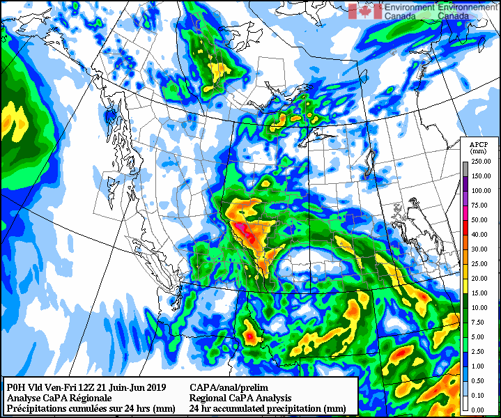
FORECASTER(S): André Bertoncini & Juris Almonte SYNOPTIC OVERVIEW: A surface low (1001 hPa) is located over the border of the NWT with a surface trough extending into Southern Alberta. This trough is the main feature today in the ECCC weather discussions and is expected to move eastward out of our study region by this afternoon. Convective activity is expected with the movement of the trough, with greatest CAPE values along the foothills. CaPA is showing heavier precipitation amounts to the north of the SPADE region over the next 24 h.
FORECASTER: Aurélie Desroches-Lapointe & Jeremy Morris SYNOPTIC OVERVIEW: The upper low tracking from the armpit of Alaska continues to travel southeastwards toward the coast mountains and is expected to distribute into a trough as the system pushes over the coast mountains into the interior of BC. The surface trough is supported by a 500 mb trough, promoting system development. The precipitation is expected to begin in the SPADE region Wednesday morning and may persist through Friday.
FORECASTERS: Jeremy Morris & Aurélie Desroches-Lapointe SYNOPTIC OVERVIEW Unsettled conditions caused by the upper low and associated trough tends to potential for spotty showers and thunderstorms across the province. Daytime warming may cause further destabilization of the air mass, further promoting thunder storms. On a larger spatial scale, there is currently no well defined surface system in our study zone, however a 500 hPa low is located above us. The low pressure system currently located over the Pacific Ocean off the Alaska panhandle is developing eastward, forming a trough off BC coast. As the system breaks apart upon reaching the coast mountains, models suggest that precipitation will reach our area by Tuesday evening or early Wednesday morning.
|
ForecastersTeam of atmospheric scientists from across the nation. ArchivesCategories |


 RSS Feed
