|
Light flurries associated with moderate convection today will dissipate as the sun sets this evening; however flurries may begin overnight again as the Rockies remain under the influence of an upper level low situated in the NWT. This will continue advecting cold air aloft that will initiate flurries again overnight and tomorrow. There may be heavier flurries on Wednesday during the day and night, with 2 cm of snow possible during both periods. Daytime maxima will reach 3-4 degrees Celsius only, likely meaning only solid precipitation over the next 48 hours. By Friday, temperatures will warm to 8 degrees Celsius during the day but the weather will remain unsettled, with showers likely through early next week. A potent storm may then affect the area by Tuesday if the GFS long term forecast comes to fruition. Time horizon is Tuesday into Wednesday of next week. Stay tuned for updates! 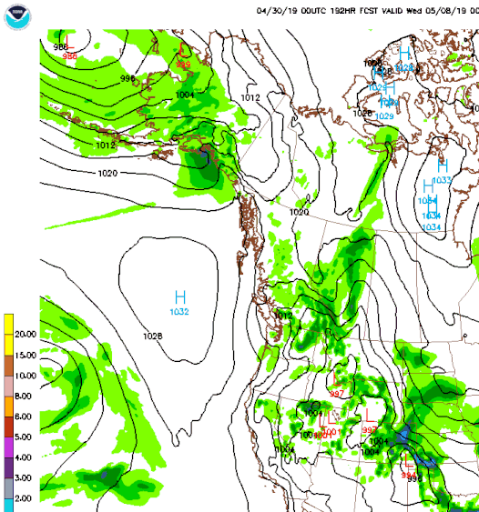
0 Comments
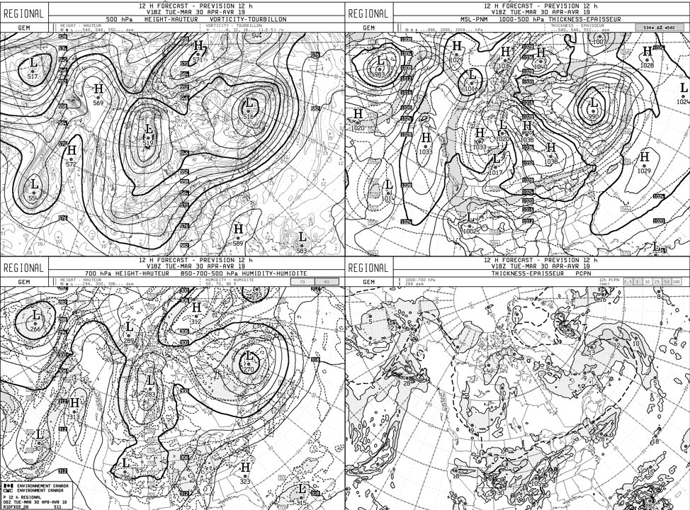
Weather forecast for Nipika Mountain Resort issued at 6:00 a.m. (13:00 Z) for 30 April 20194/30/2019 Forecaster: Stephen Déry Weather across Kootenay National Park will remain unsettled today due to the continued presence of a deep upper level low (519 dam) with the center situated just east of Great Slave Lake, Northwest Territories. Upper level flow remains northerly and will continue to advect cold air aloft over the Canadian Rockies over the next two days as it continues to deepen. There is no major system as the surface with only a weak (1017 hPa) low in Saskatchewan with a weak trough of low pressure extending back towards southern Alberta and BC. Today’s weather will start off with clear, cold conditions (currently -3°C in Radium Hot Springs) and calm winds. By mid-day, sunny weather will likely lead to localized convection in the mountains with cumulus congestus developing. Deeper convection may lead to showers or flurries with the chance for graupel in more intense cells. The maximum temperature today is 2°C with warmer temperatures when the sun pokes through the clouds. Chance for precipitation will be near zero this morning but increase to 60% in the afternoon once convection initiates. At sundown, clouds and precipitation will dissipate and air temperatures will cool off rapidly. Current radar image shows heavy precipitation moving towards our field sites. - 4/27/2019 repost4/29/2019 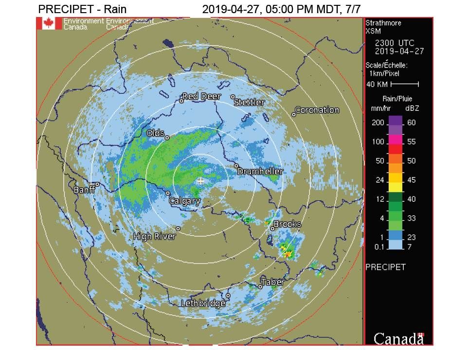 Image provided by Stephen Dery.
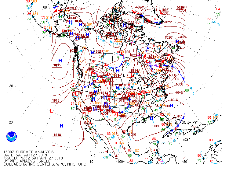 Image was provided by Stephen Dery.
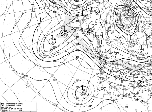
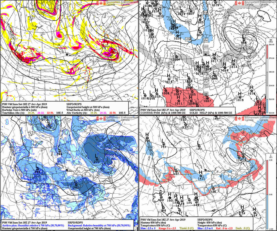
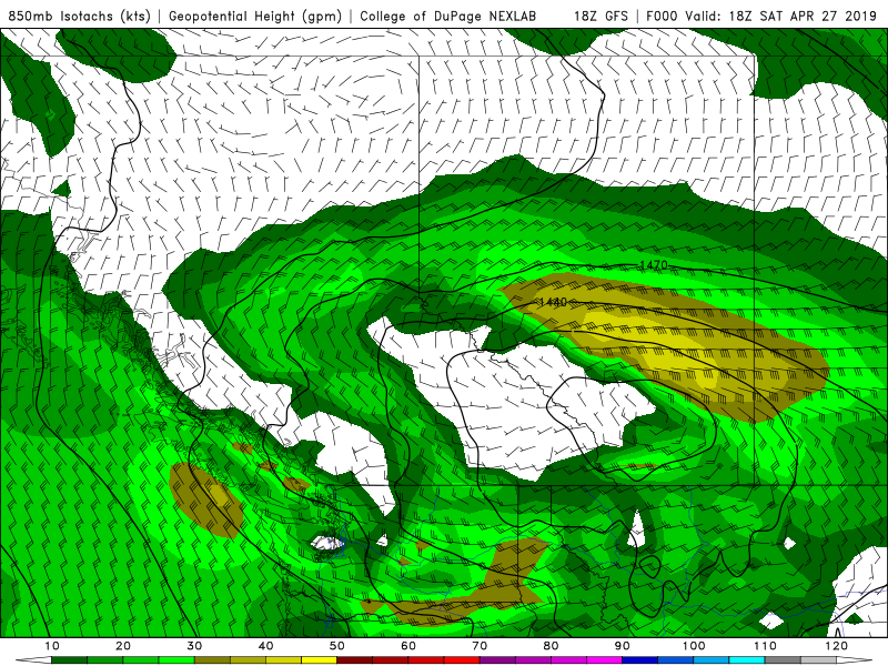
While snow beings to melt here in Prince George hopefully this post will give some indication to the SPADE crew on the ground an idea of what to expect in the next 12-24 hours. Summary: The low pressure system that brought snow to areas of British Columbia Friday night will impact the Eastern side of the Rockies this evening and into the morning of the 28th. The passage of a cold front expected to affect the study area Saturday evening will bring snowfall amounts in the region of 10-30 cm, with strong winds up to 90 km/hr occurring in the wake of the front, with peak wind gusts around Saturday midnight. The cyclonic rotation of the storm as passes down the Eastern flank of the Rockies could bring higher snow amounts due to up slope flow that can already be observed on CMC radar. Snow and winds will taper from the Northern areas first, following a southwards trend. The location of the low can be seen on the CMC surface analysis from 18z. The upper level low in the 500 hPa panel (12z) is still to the west of the surface low indicating the westwards tilt with height will support the further development of the storm until after it exits the study area. Good luck folks! -Hadleigh Thompson ECCC Alerts for: Kananaskis - Canmore Warnings 3:27 PM MDT Saturday 27 April 2019 Snowfall warning in effect for:
A spring storm over Alberta has already brought heavy snow to west-central regions of the province. As the storm continues to track south this evening, heavy snow will spread into southern and eastern regions. Snowfall totals are expected to be in the 10 to 20 cm range with locally higher amounts up to 30 cm over higher terrain. The heavy snow will continue to taper off from the north this evening and overnight, except in the southern foothills where snow should linger into Sunday morning. Please continue to monitor alerts and forecasts issued by Environment Canada. To report severe weather, send an email to [email protected] or tweet reports using #ABStorm Weather for today and tomorrow should bring sun and a bit of wind for the installation of the field stations. By thursday night, isolated precipitation of snow should start, culminating Saturday, when strong easterly winds could bring around 30 cm of snow in Canmore. Hopefully, most of our instruments will be deployed, making this event a good test for our field campaign. To be continued... 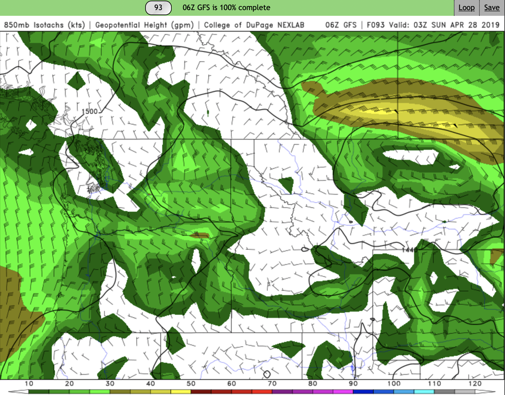 |
ForecastersTeam of atmospheric scientists from across the nation. ArchivesCategories |


 RSS Feed
