GLOBAL WATER FUTURES
  • Updates
  • Blog
  • Photos
  • Forecast
  • Mission Statement
  • Participant Information
  • People Involved
  • Instruments
  • Contact us
  • Minutes

Forecast

June 1 - 0300 UTC

5/31/2019

0 Comments

 
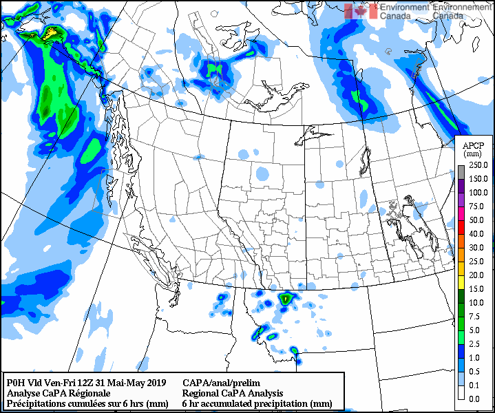
FORECASTER: Juris Almonte 
SYNOPTIC OVERVIEW: Much like the morning, the upper ridge at 500 hPa is still affecting western Canada, a low pressure system is situated off Alaska. Atmospheric river forecasts are showing IVT values over  the 250 kg m-1 s-1 threshold by June 2nd and 3rd and then again on the 5th. Upper air charts are from 1200 UTC, as 0000 UTC charts were not available.

​Of interest next week, high amounts of precipitation are expected on the 5th according to the GEM 2.5. This may be associated with the long range atmospheric river forecast whereby, moisture is advected over to the Rockies from the Pacific. 

NIPIKA
GEM 2.5 (1800 UTC) shows small (1.5 mm) precipitation over Nipika. Radar has shown spotty convection on the western side of the divide. Tomorrow is similar, with 1.8 mm expected late afternoon when max. temperatures are reached. 

The American models, with the newest model run suggests little action tomorrow, HRRR (0000 UTC), RAP (0100 UTC).  Even NAM earlier today (1800 UTC) shows no precipitation. 


FORTRESS
GEM 2.5 (1800 UTC) shows precipitation over Fortress for the rest of the evening with 6.7 mm of rain till midnight (MDT). However, looking at the radar it looks like strongest cells occurred just to the south of Fortress.
Picture

Tomorrow is similar, with 5.8 mm simulated mid afternoon, when CAPE value reaches a max  ~1100 J/kg, though shear is not as high.

Again, with the American models, and the most recent model runs almost no precipitation is shown tomorrow. 

​Storm Lodge
According to the GEM 2.5 (1800 UTC) no precipitation is expected. 
​
0 Comments

May 31 - 1430 UTC

5/31/2019

2 Comments

 
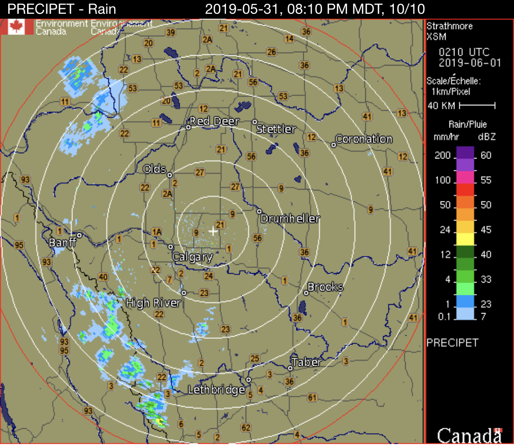
FORECASTER: Hilary Smith

SYNOPTIC OVERVIEW: There is a high pressure system affecting the SPADE area and a developing trough to the west of the SPADE region from Yukon through BC into the US. There is currently nothing popping up on the radar for either of the field sites and we will be monitoring the radar throughout the day and nowcasting. Thunderstorms are possible at both sites. 
NIPIKA
The GEM2.5 km (0600 UTC May 31) model run suggests that rain may occur from 21oo UTC May 31 to 0600 UTC June 1 with an approximate accumulation of 15.7 mm, and a precipitation maximum of 11.6 mm from 0400 UTC to 0500 June 1. CAPE values are moderate with a maximum value of ~1000 J/kg at 1800 UTC. The long term GEM (1200 UTC May 31) model shows 1 mm of rain occurring tomorrow and then clear for the next few days. The HRRR (1300 UTC May 31) model run shows light rain today, starting at 2200 UTC onward. The RAP (1300 UTC May 31) model run shows rain occurring from 2300 UTC  May 31 to 0500 UTC June 1, with an approximate accumulation of 8.6 mm and possible thunderstorms. The NAM is showing no precipitation.

​Temperatures are likely to be in the mid-twenties, with light SE winds that will become variable into the evening. 
FORTRESS
There is an air quality statement in effect for the region due to smoke from wildfires in N. Alberta. The thickest smoke may move northwesterly over the course of the day, but conditions may remain hazy into the weekend. 

​The GEM2.5 km (0600 UTC May 31) model run suggests that 0.5 mm of rain may occur from 1800 UTC to 1900 UTC and then clear. CAPE values are moderate with a maximum value of ~1000 J/kg at 1800 UTC. The long term GEM (1200 UTC May 31) model shows trace amounts of rain occurring in the afternoon and then clear for the next few days. The HRRR (1300 UTC May 31) model run shows rain from 2100 UTC May 31 to 0500 UTC June 1 with an approximate accumulation of 17.9 mm. The RAP (1300 UTC May 31) model run shows rain occurring from  2000 UTC May 31 to 0200 UTC June 1 with possible thunderstorms. The NAM (0600 UTC May 31) model run shows rain occurring from 2000 UTC May 31 to 0600 UTC June 1 with an approximate accumulation of 10.11 mm and possible thunderstorms.

Isolated thunderstorms are possible this afternoon, however smoke could reduce the daytime highs and, therefore, instability. 

​Temperatures are likely to be around 15°C, with moderate SE winds that may become light and NW in the afternoon and then shifting back to SE.
2 Comments

May 31 0200 UTC

5/30/2019

0 Comments

 
FORECASTER: Selina Mitchell

SYNOPTIC OVERVIEW: Widespread instability will give rise to showers with a risk of thunderstorms. Convection is expected mainly over ridge tops. Isolated showers are expected for the East Kootenays and the Elk Valley tomorrow morning. Also, afternoon convection is expected tomorrow in Alberta. There is a possibility of thunderstorms in southwestern Alberta. Overall, there is a greater risk of severe weather tomorrow, but the risk is still marginal. More instability is expected over the weekend throughout the study area.
NIPIKA: Both the HRRR and GEM 2.5 do not predict any precipitation for tonight or tomorrow. However, the NAM predicts intermittent rain throughout the night at Nipika (ending at 5 AM) with a total accumulation of 13.7 mm. None of the models predict precipitation for tomorrow and highs are expected to be between 18 and 20 C. There is currently no precipitation around Nipika according to radar imagery.
FORTRESS: All three models predict precipitation this evening or tonight. The GEM 2.5 predicts precipitation ending at 7 PM. However this was not supported by radar imagery. Little to no precipitation has been seen above Fortress within the past hour on the radar. The HRRR predicts rain until 10 PM tonight with a total accumulation of 8mm. The NAM predicts that precipitation will occur until 3 AM tonight with a total accumulation of 40 mm. Models disagree on precipitation tomorrow. Rain will start at 6 AM and go until 8 PM tomorrow according to the NAM with a total accumulation of 13 mm. Meanwhile according to the GEM 2.5 it will rain between 3 PM and 8 PM with a total accumulation of 3 mm. The HRRR predicts no rain for tomorrow.
0 Comments

May 30 - 1400 UTC

5/30/2019

0 Comments

 
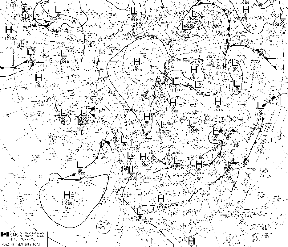
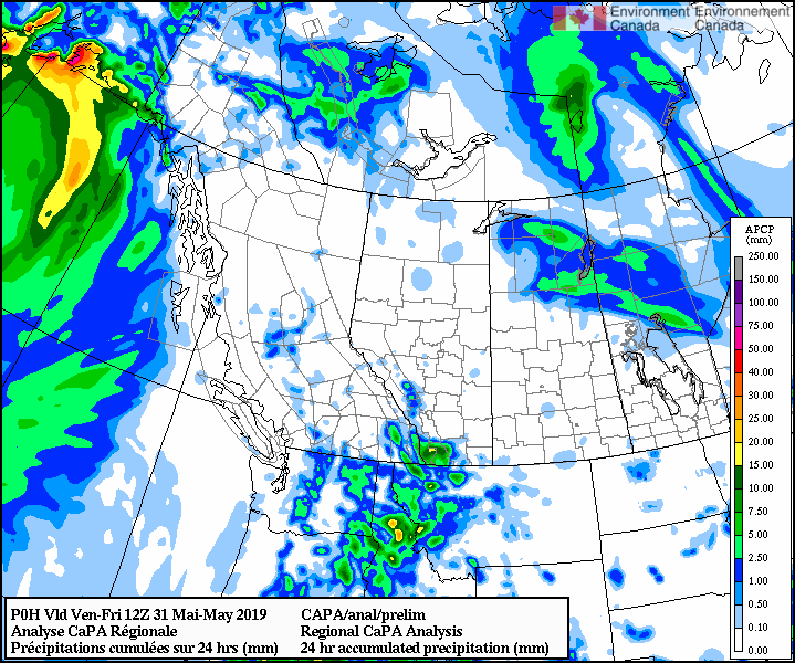
FORECASTER: Juris Almonte
SYNOPTIC OVERVIEW: Low pressure system over Washington state bringing and a low pressure over the northern border of AB and SK. The cold front is moving southwest over AB and SK, but will transition to more of a southerly direction as the low pressure moves SE towards Minnesota state tomorrow morning. 
Nipika
GEM 2.5 (1800 UTC) shows total accumulated rain is expected to be around 3.7 mm of rain. CAPE values are ~1100 J/Kg, with low shear levels. First lightning strikes occurred on eastern side of divide. 

HRRR, RAP and NAM are in agreement with convective precipitation occurring today. HRRR, RAP and NAM are showing amounts of 22.8 mm, 15.4 mm and 9.6 mm today. 

​Temperatures to reach a high of ~23°C. 
Fortress
GEM 2.5 (1800 UTC) total accumulated rain  is expected to be around 3 mm. Already on Strathmore radar, convection popping up on the peaks of the mountains on both sides of the Kananaskis Valley earlier this morning (~1000 UTC). 

HRRR, RAP and NAM showing various rain amounts, with RAP showing the highest amounts today (~10.9 mm).

Heavier convection expected on Friday (~11 mm of rain). 

Temperatures to reach a high of ~13°C
0 Comments

May 30-0200 UTC

5/29/2019

0 Comments

 
FORECASTERS: Charlie Hébert-Pinard, Hilary Smith & Selina Mitchell

SYNOPTIC OVERVIEW: The stationary front in the north of Alberta is now a cold front moving to the south east. It is going to bring some precipitation and maybe even some thunderstorms on is way, but these might not occur until it is south of the study region. It will at least bring convection to our area with a small probability of thunderstorms, but since the air is pretty dry and smoke advisory is still in effect, the energy available for this is limited. However, convection in our area could also come from a small low pressure coming from the South.
Nipika
For tomorrow, we are expecting temperatures around 20 C. According to GEM2.5, it should rain from 8pm to 2am for a total amount of 11.8mm. But of course NAM is giving almost double the precipitation, starting at 9am MDT and going all day. So there is low risk of shower all day tomorrow and thunderstorm in the afternoon.
Fortress
On Fortress side, we are expecting temperatures up to 15 C. The GEM2.5 is giving rain from 12pm to 4pm MDT, while the NAM identifying the start as 4pm MDT. Both show precipitation overnight, so it would be advisable to check again. The total rain amount could be only 2.8mm or 17.8mm depending of the models.
0 Comments

May 29 1400 UTC

5/29/2019

0 Comments

 
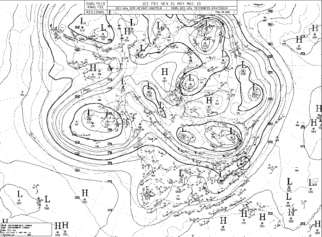
FORECASTERS: Charlie Hebert-Pinard and Selina Mitchell

SYNOPTIC OVERVIEW: Currently the atmosphere is fairly stable and there is little moisture in the air. There is a gentle upper ridge spanning the province of British Columbia that will divert major systems from the province. However, there are subtle systems embedded in this ridge and they will give rise to convective precipitation including in areas around the Elk Valley. There is a stationary front just slightly to the north of our study area that will give rise to precipitation, but it is unlikely to affect us.  There is currently a lot of smoke in the region.

NIPIKA: Warm temperatures are expected today with highs between 15 and 20 C. However, the forecast for Kootenay National Park is for a high of 24 C. Precipitation may be expected as early as 5 PM today with a total accumulation of 4 mm according to the HRRR model. GEM 2.5 predicts no precipitation for today and NAM predicts negligible precipitation.
FORTRESS: Warm temperatures are expected today with highs between 15 and 20 C. Highs of 26 are expected in Canmore and Kananskis. Negligible precipitation is expected starting at 4 PM today according to the GEM 2.5. The other two models are expecting no precipitation today, but precipitation starting around noon tomorrow with total accumulation between 7 mm and 10 mm.
0 Comments

May 28 -1400 UTC

5/28/2019

0 Comments

 
FORECASTER: Juris Almonte
SYNOPTIC OVERVIEW: Conditions remain the same, with a strengthening upper ridge over Northern BC and AB and extending into the YK and NWT. Again, this will cause stability in the atmosphere. A weak trough will make its way onshore by Wednesday.
NIPIKA
Blue skies overhead for this morning with some cloud cover in the afternoon and evening.  Temperatures are expected to be warmer than the Bow Valley at ~23°C today and ~24°C tomorrow.

​A chance of some convection tomorrow. GEM global show some convection over Thursday and Friday. HRRR, RAP and NAM show nothing.
FORTRESS
Should be a bluebird day, with temperatures to hit a high of 14°C and nearing 17°C tomorrow. Within the valley, temperatures are to reach 21°C today and ~24°C tomorrow. 

GEM, NAM, HRRR, RAP are all in agreement, predicting no precipitation till Thursday. Both GEM global and NAM suggests some convective activity when the weak upper trough makes its way as the upper level high begins to weaken.
0 Comments

May 27 - 1330 UTC

5/27/2019

0 Comments

 
FORECASTER: Charlie Hébert-Pinard, Selina Mitchell & Juris Almonte
SYNOPTIC OVERVIEW: Similar to yesterday's forecast, a high pressure system is encompassing most of the prairies and to the Great Lakes. The upper level ridge has moved onshore with the crest over Northern BC, bringing mainly fair weather for most of the province. The weak is forecasted to weaken by Wednesday, which will bring some spotty convection over SPADE region. 
 NIPIKA
Stable conditions over the area for the next two days, with temperatures up to 20°C today and warmer yet tomorrow, up to 22°C. Winds are predominantly northerly.
FORTRESS
​Stable conditions over area for the next two days, with temperatures nearing 12°C today and 14°C tomorrow, but within the valley temperatures will be much warmer at 20°C and 24°C tomorrow. Winds are switching from SW to more northerly tomorrow. 
0 Comments

May 27th - 0200 UTC

5/26/2019

0 Comments

 
Forecaster : Cécile Carton

SYNOPTIC OVERVIEW
Our area remains clear, we should observe stable conditions over the following days.
NIPIKA
As forecasted this morning, the models (GEM2.5, HRRR and NAM) agree to say there will be no precipitation over the following days, and the GEM10 even suggests it will remain clear until Thursday. Temperatures up to 20°C tomorrow, 5°C during this night.
FORTRESS
As forecasted this morning, the models (GEM2.5, HRRR and NAM) agree to say there will be no precipitation over the following days, and the GEM10 even suggests it will remain clear until Thursday. Temperatures up to 11°C tomorrow, -3°C during this night.

0 Comments

May 26 - 1500 UTC

5/26/2019

0 Comments

 
FORECASTERS: Juris Almonte & Cécile Carton

SYNOPTIC OVERVIEW: Surface high pressure system over the Pacific off the coast of BC and northwestern US. There is an upper low located over northern California, which is causing some of the lingering instability over southern BC, which is still observed over the radar this morning. Though nothing is shown over our area. 
Nipika
As forecasted yesterday and according to the GEM 2.5, the HRRR and the NAM, fair weather is expected for the next couple of days as the ridging off the BC coast will bring temperatures ~15°C and ~20°C Sunday afternoon. There will be gentle breeze this afternoon and calm wind conditions for Sunday. A temperature of 4°C is expected during the night.
The GEM 10 suggests it will remain clear until Thursday.
Fortress
According to the GEM 2.5, the HRRR and the NAM, no precipitation is expected over Fortress over the next two days. Temperatures are supposed to reach around 7°C and 12°C today and tomorrow respectively, and will not exceed -4°C during the night.
The GEM 10 suggests it will remain clear until Thursday.

​
0 Comments
<<Previous

    Forecasters

    Team of atmospheric scientists from across the nation.

    Archives

    June 2019
    May 2019
    April 2019

    Categories

    All

    RSS Feed

Powered by Create your own unique website with customizable templates.
  • Updates
  • Blog
  • Photos
  • Forecast
  • Mission Statement
  • Participant Information
  • People Involved
  • Instruments
  • Contact us
  • Minutes