|
FORECASTER: Juris Almonte SYNOPTIC OVERVIEW: An upper level ridge is situated over Northern AB/NWT, advecting warm southern air over the Rockies and resulting in stable conditions over the SPADE region. Surface low pressure over southern BC (1000 hPa) and off the coast of BC (989 hPa). 24 h CaPA for Monday May 20th, has no accumulated precipitation over the area. There may be some scattered precipitation over the Rockies tomorrow.
0 Comments
FORECASTER: Hilary Smith SYNOPTIC OVERVIEW: There is a large surface ridge situated over the majority of Saskatchewan, Manitoba, and north western Ontario. A high pressure system is situated over Yukon and there is low pressure off the west coast. There is an upper level high over northern Alberta and extending into a good portion of southern Alberta and the Rockies. 6-hour CaPA indicates very little precipitation accumulation in the region. No precipitation is showing on the radar over the SPADE region. It looks like it's going to a beautiful, albeit a little chilly, day!
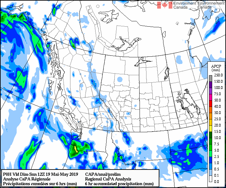
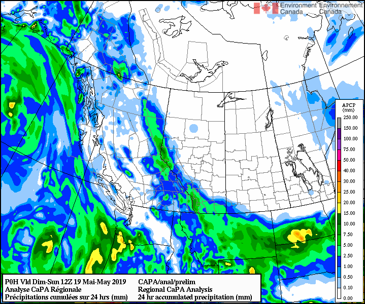
FORECASTER: André Bertoncini REGIONAL SYNOPSIS: The synoptic situation that is causing this light intensity albeit widespread precipitation is a through that is situated in the Canadian Rockies. The general wind circulation caused by this through is from SE. Radar at the moment shows a large band of light precipitation stretching along the Canadian Rockies axis. CaPA is showing a 1 mm precipitation accumulation along the continental divide in the past 6 hours from 0600Z.
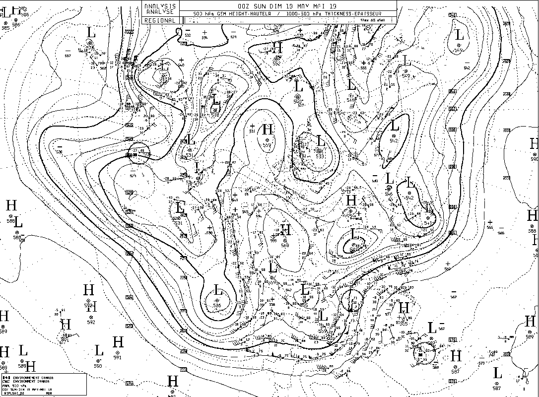
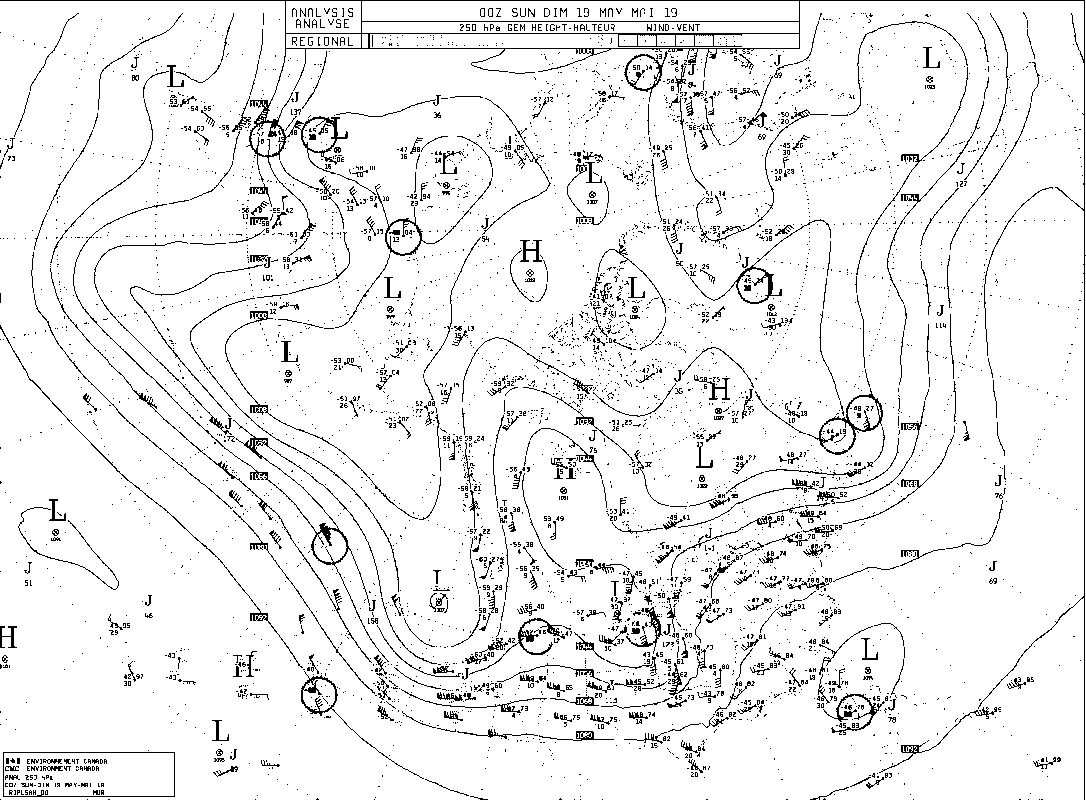
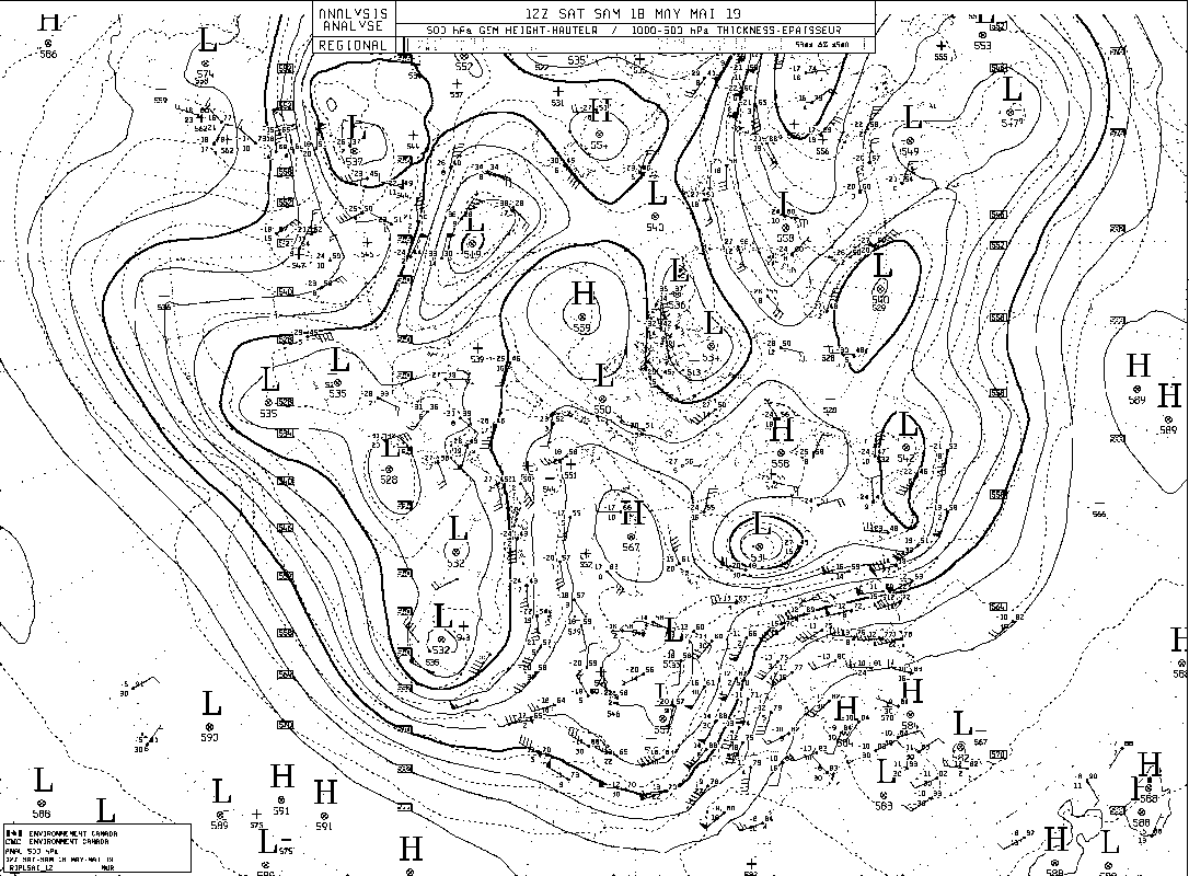
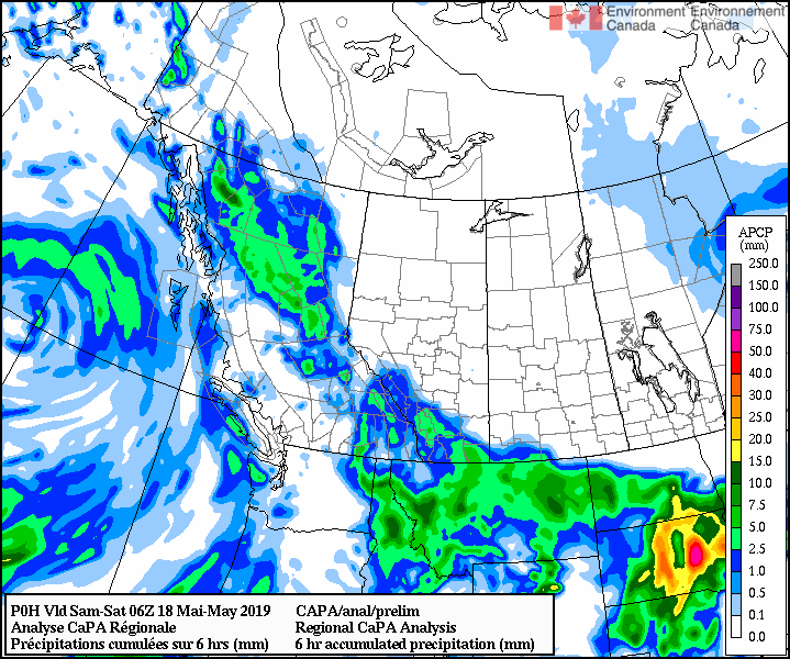
FORECASTER(S): Juris Almonte & Hilary Smith SYNOPTIC OVERVIEW: The surface low over interior southern BC has further deepened (999 hPa), with another and deeper low (989 hPa) over the eastern North Pacific. This low over the Pacific is moving moisture from the Pacific towards the coast, however no atmospheric river is expected over our region according to IVT forecasts. Upper level charts show southerly flow over the continental divide, as moisture from the Pacific moves around the Sierra Nevada range and heads northward towards the SPADE region, which was observed via satellite imagery. Overall a wet May long weekend for both sides of the divide. Precipitation should be easing up by Sunday.
FORECASTER: Juris Almonte SYNOPTIC OVERVIEW: Similar to the previous forecast, a low pressure system is situated over southern interior of BC, bringing SE flows to the SPADE area.
FORECASTER: Stephen Déry SYNOPTIC OVERVIEW: A low pressure developing in the central interior of BC is advecting moisture northward towards the continental divide with associated precipitation. This initial round of moisture advection will abate with drier air filtering in from the Pacific Northwest of the United States before a second round of moisture affects the area. This southerly flow of air is associated with a deep upper level trough and associated low level cyclone off the coast of northern California. This pattern will progress slowly eastward while continuing to push moisture into the Canadian Rockies into the weekend.
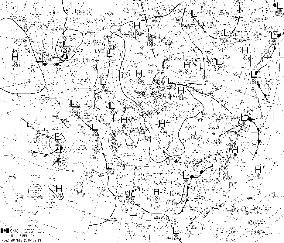
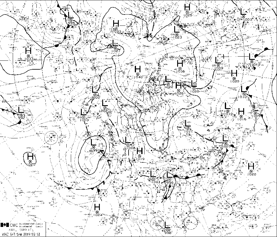
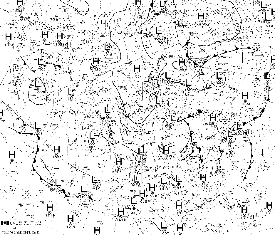
Forecaster: Juris Almonte SYNOPTIC OVERVIEW: Latest 1800 UTC CMC surface analysis maps show a low pressure system situated over southern SK (1002 hPa). With this system we are getting surface Easterly winds moving upslope the foothills. General consensus between models suggest that prolonged precipitation will occur tonight, with varying start times.
Forecaster : Cécile Carton Synoptic analysis Presence of a low for now located on the Western British Columbia. The presence of a ridge in the south of Canada, and a trough on the Pacific northern coast, create a south-western flow which is expected to bring this disturbance over us during the night.
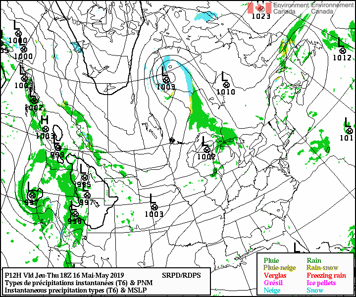
Synopsis: Although the upper level pattern remains similar to this morning forecast (see previous post), the occluded system has now morphed into a decayed front, remaining off the coast of BC while another small disturbance has appeared to pass unobtrusively over the region during today, Scattered light showers may occur throughout the region this evening but not with particular intensity. Of greater interest is a low pressure system expected to develop in the gulf of Alaska in the next 24 hours that will make its way towards the forecast region during 16 and 17 May. This will be supported by an upper level trough and could be strong enough to impact the region during Wednesday night and early Thursday morning (MDT). -- Hadleigh Thompson   Synoptic overview: A southwesterly pattern aloft prevails over the forecast region with a broad low amplitude ridge spanning the central interior of BC and a shortwave trough continuing to dig it way towards the west coast. An occluded system remains off the south coast and is slowly making its way towards landfall later today/tonight. The remnants of the associated cold front will give some unsettled weather and scattered showers over the region later today in into Wednesday morning as it passes over in a northeastwards direction. Nipika: Light precip begins at 3 pm (MDT) with scattered amounts of trace precip throughout the day until 5 am (MDT). Fortress: Scattered showers beginning around 3 pm (MDT) finally clearing at 5 am (MDT). Winds will be light to moderate from the southwest with stronger periods during the earlier hours of Wednesday morning (MDT). Uncertainty exists due to the fickle nature of the cold front and the unknown rate that it may dissipate as it moves over the mountainous interior of BC. -- Hadleigh Thompson   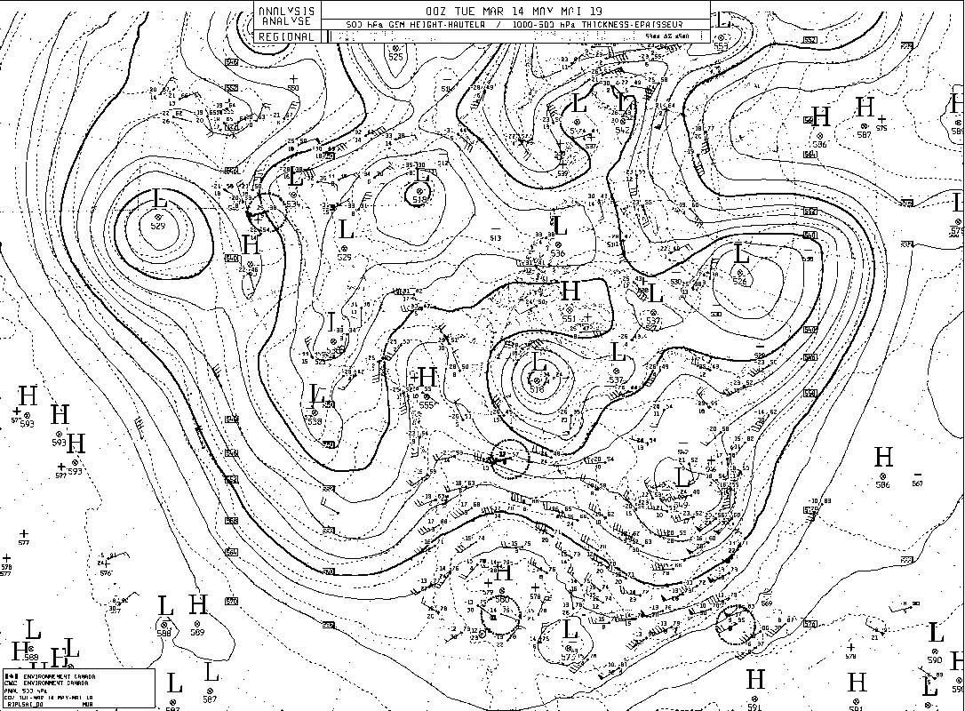 |
ForecastersTeam of atmospheric scientists from across the nation. ArchivesCategories |


 RSS Feed
