|
FORECASTER: Aurelie Desroches-Lapointe, Hilary Smith & Juris Almonte SYNOPTIC OVERVIEW: An omega block has manifested itself over Canada. Two low pressure systems, one off the Pacific Coast (1003 hPa) and the other over Northern MB (998 hPa), with a high pressure system over the border of northern BC & AB. This synoptic pattern will lead to some prolonged precipitation that will likely intensify as the Pacific low deepens and moves closer to the BC coast. This Pacific low may also bring an atmospheric river that may cross the continental divide.
0 Comments
FORECASTERS: Hilary Smith & Juris Almonte SYNOPTIC OVERVIEW: Low pressure system (998 hPa) over Northern AB/SK. Cold front situated over the BC/AB border. Winds over SPADE region are generally westerly. Upper level winds charts are showing that we are on the periphery of the ridging pattern.
DATE/TIME: May 12 - 1400Z FORECASTER/S: André Bertoncini Regional Synopsis: It seems that the region is changing the weather pattern to a low pressure system associated with a through. The general wind circulation is predominantly westerly. CaPA does not indicate any accumulated precipitation in the last 24 hours in the region. Nipika: Both high resolution models (GEM 2.5 km and HRRR) predict little to no precipitation to happen in the Nipika region – GEM km predicting 0.1 mm of rainfall on May 13 1100Z. Temperatures should vary between 5 to 20 ºC, with low relative humidity during the day. Cloud cover will increase on May 13 0900Z. Fortress: The forecast for Fortress is similar to Nipika for May 12, however precipitation forecast for May 13 is predicted at higher volumes in this site from GEM 2.5 km. Rainfall is predicted to start on May 13 0900Z, transitioning to snowfall at 1300Z, coming back to rainfall and ending at 1800Z. There is also a 0.4 mm small event predicted to happen in late afternoon May 13 2300Z. Temperatures should remain between 0 to 10 ºC on May 12 and 2 to 10 ºC on May 13. HRRR forecast for May 12 is similar as GEM 2.5 km. On the radar, there are some precipitation bands moving with a westerly flow North of Banff, but probably dissipating in the next few hours. Forecaster: Juris Almonte Synoptic Overview - Low pressure system over southern BC (1010 hPa). Upper level winds show ridging pattern over Rockies, with warmer temperatures aloft, bringing stability over the area.
FORECASTER: Juris Almonte SYNOPTIC OVERVIEW: Surface high pressure situated over AB (1017 hPa). Deep low over Alaska (998 hPa), with a cold front currently over the the Eastern Pacific and making its way eastward. Upper level winds show ridging over BC.
FORECASTERS: Selina Mitchell, Cécile Carton & Hilary Smith SYNOPTIC OVERVIEW: High pressure system above the area and likely moving eastward. Winds are generally WNW. Warm temperatures on both sides of the divide.
FORECASTER: Juris Almonte SYNOPTIC OVERVIEW: The ridging pattern is still strengthening over BC, and upper level winds at 250 & 500 hPa moving warm air eastward. Once again, two high pressure systems are located on the coast of BC (1034 hPa) and over Southern Alberta (1027 hPa). This is setting itself up as an omega blocking pattern, with warmest temperatures over the western side of the continental divide.
Forecasters: Hadleigh Thompson & Stephen Dery Synopsis: Once again there is no major system affecting the Rockies this morning with a weak high pressure system (1026 hPa) residing in southern Alberta and a weak low pressure system (1015 hPa) in northern Washington. This pattern is leading to a southerly low-level flow over the southern Canadian Rockies that will break down as high pressure develops over the study area. A blocking pattern is setting up over western Canada with strong upper level ridge and accompanying surface high pressure over the Rockies, which will keep the weather warm and dry the remainder of the week. Nipika: Partly cloudy conditions with a slight (40%) chance of showers today, most likely as thunderstorms in the early evening (6 pm MDT). Temperatures will remain on the mild side and likely reach 13°C by the afternoon. Fortress Mountain: Conditions will remain cool at Fortress Mountain today but should surpass the freezing mark today in periods of clear skies. Some very light precipitation (<1 mm) is possible starting around noon with possible convection around 6 pm leading to ~4 mm of accumulation. 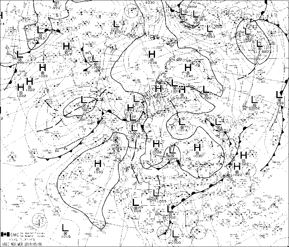   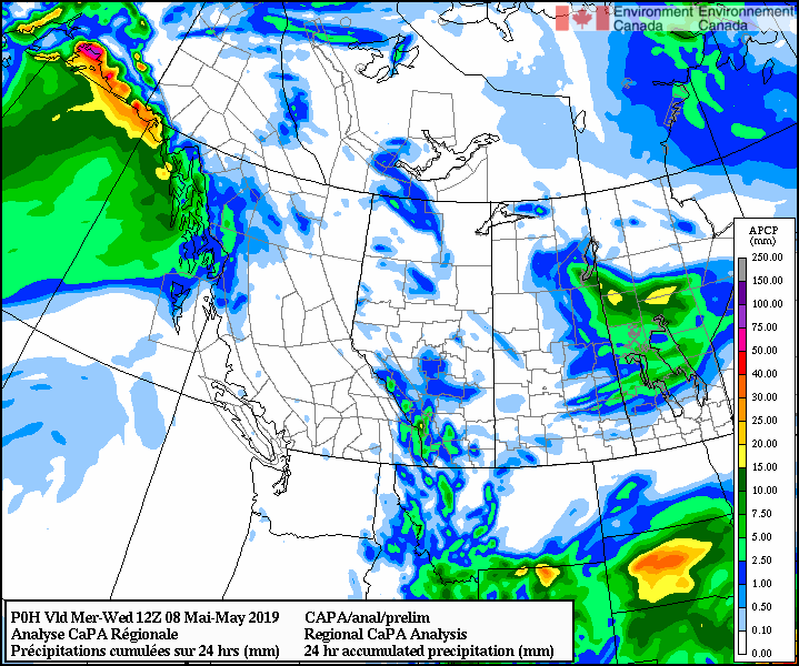 FORECASTERS: Aurelie Desroches-Lapointe & Juris Almonte SYNOPTIC OVERVIEW: Upper level trough over AB is moving eastward and will be replaced with a H pressure system, bringing with it calm conditions. However, there may be local orographic effects. ECCC weather discussion over the western prairies mentions areas of enhanced precipitation due to vorticity centres that are along the ridge, off the foothills of the Rockies.
Forecaster: Stephen Dery Synoptic overview: There is no major system affecting the Rockies this morning although the area resides in a weakness between two high pressure systems, one in southern Manitoba and the other in the eastern Pacific Ocean. An area of light to moderate precipitation is affecting southeastern Alberta and moving to the southeast. Nipika Partly cloudy conditions with a slight (30%) chance of showers today. Temperatures will remain on the mild side and likely reach 10°C by the afternoon. Fortress Mountain Conditions will remain cool at Fortress Mountain today and barely reach the freezing mark. Northwesterly flow will advect cool air and clouds, yielding a wintry feel in the air. Light precipitation is expected from early morning until afternoon. |
ForecastersTeam of atmospheric scientists from across the nation. ArchivesCategories |


 RSS Feed
