GLOBAL WATER FUTURES
  • Updates
  • Blog
  • Photos
  • Forecast
  • Mission Statement
  • Participant Information
  • People Involved
  • Instruments
  • Contact us
  • Minutes

Forecast

Snow coming this weekend - 4/24/2019 repost

4/29/2019

1 Comment

 
Weather for today and tomorrow should bring sun and a bit of wind for the installation of the field stations. By thursday night, isolated precipitation of snow should start, culminating Saturday, when strong easterly winds could bring around 30 cm of snow in Canmore. Hopefully, most of our instruments will be deployed, making this event a good test for our field campaign. To be continued...
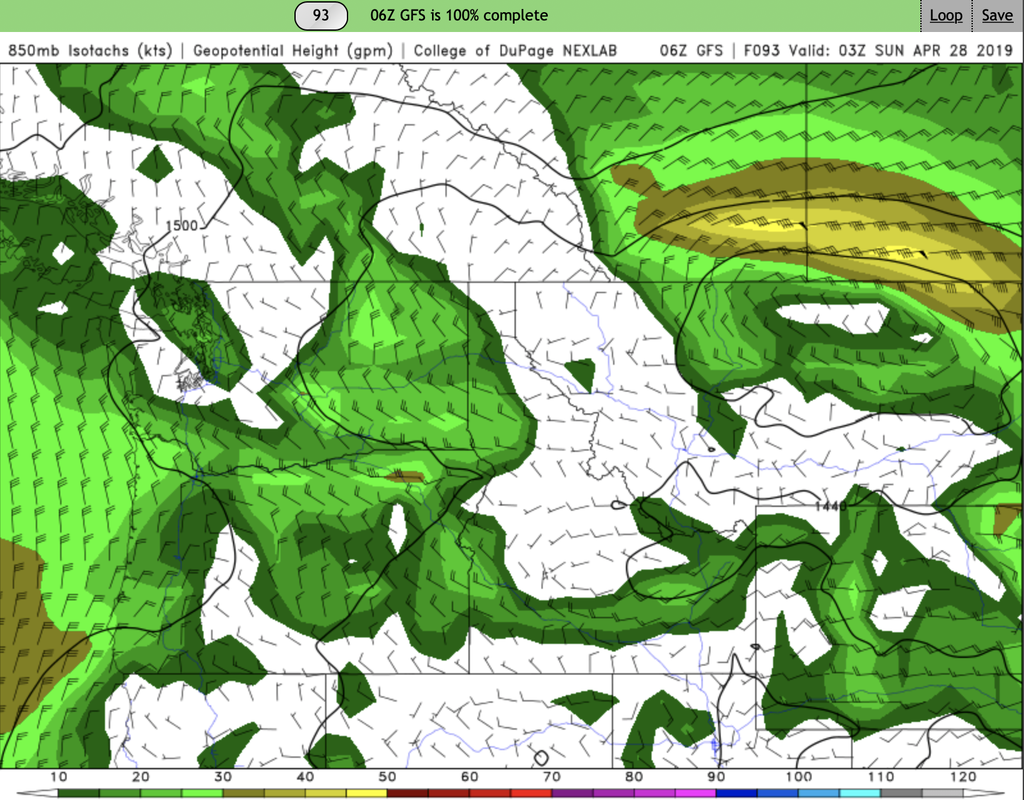
Picture
1 Comment
STEPHEN DERY
4/29/2019 02:08:47 pm

Weather Watch/Latest Forecast Kananaskis / Canmore

4:30 PM MDT Friday 26 April 2019
Winter storm watch in effect for:

Kananaskis Improvement District near Highwood House
Kananaskis Improvement District near Kananaskis Village
M.D. of Bighorn near Canmore Exshaw and Ghost Lake
M.D. of Bighorn near Ghost River Wilderness
A spring storm is forecast to move into Alberta bringing a wide range of weather conditions to the southern third of Alberta on Saturday

Beginning Saturday afternoon, showers are expected to develop over southeastern Alberta with possible embedded thunderstorms. With these weak non severe thunderstorms, there is a possibility of seeing a funnel cloud or two develop as the low passes over the Brooks to Medicine Hat region in the afternoon hours.

The rain showers over southeastern Alberta will quickly change over to snow in the early evening hours with total amounts in the 15 to 25 cm range for areas from Coronation to the Cypress Hills with enhanced amounts over the Cypress Hill possibly exceeding 30 cm. Additionally, strong easterly to northeasterly winds will develop overnight Saturday night giving blizzard like conditions to the area.

Over western Alberta, a quick blast of snow to the Highway 2 corridor will combine with northerly winds gusting to 90 km/h, giving possible brief whiteout conditions to the area in the later afternoon hours.

Over the Kananaskis region, possible snowfall accumulations may reach 20 cm starting Saturday afternoon and tapering off Sunday morning.

Avoid travel if possible. Visibility may be suddenly reduced at times in heavy snow.

Winter storm watches are issued when multiple types of severe winter weather are expected to occur together.

Please continue to monitor alerts and forecasts issued by Environment Canada. To report severe weather, send an email to ABstorm@canada.ca or tweet reports using #ABStorm.

Reply


Leave a Reply.

    Forecasters

    Team of atmospheric scientists from across the nation.

    Archives

    June 2019
    May 2019
    April 2019

    Categories

    All

    RSS Feed

Powered by Create your own unique website with customizable templates.
  • Updates
  • Blog
  • Photos
  • Forecast
  • Mission Statement
  • Participant Information
  • People Involved
  • Instruments
  • Contact us
  • Minutes