
Nipika Fortress
20 Comments
Nipika Fortress
Nipika Fortress Storms not what we expected... The forecast on May 12th, with emphasis using the GEM 2.5 had us excited about a transition event from rain to snow on the Fortress side and some rain expected on the Nipika side. Teams were organized on both sides and were told to wake up at 4 AM to check our updated weather briefing on slack. Here is what our discussions on slack looked like: "Pcp forecast from GEM2.5 looks good, current radar showing patchy pcp in southern BC moving towards the divide, will re-evaluate in 2 hours" - Professor Déry "Hilary and I suggest being on site by 0530 MDT. GEM 2.5 shows heavier pcp beginning at 6 AM MDT. Radar showing light precip (trace amounts) around Nipika area moving E. Trace precip to arrive at Fortress ~0445 MDT. Storm to end ~0900 MDT" - Juris
Nipika 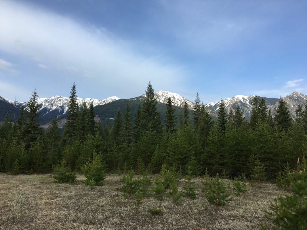 View from the field site Fortress 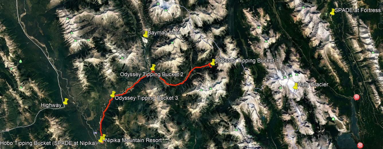 The precipitation gauge transect from Nipika to the continental divide is drawn in red. Each tipping bucket is marked with a yellow pin. Yellow pins outside of the transect denote places where additional weather measurements are currently being obtained, or could be obtained in the future. The Fortress SPADE site is located in the upper right hand corner of this map. Hadleigh, Cécile, and Selina departed Radium Hot Springs for Nipika Mountain Resort at 1530 UTC for a fantastic mountain journey. Our mission was to deploy a transect of tipping bucket rain gauges from the Nipika site to the continental divide. Unfortunately, an inspection of the Nipika site at 1030 MDT revealed that the Parsivel disdrometer had a timeout error and, consequently, two days of fine weather Parsivel information was missing from our computer (although the instrument itself was still puttering along nicely). Hadleigh quickly restarted the Parsivel software, and this disdrometer information easily flowed back onto the computer screen, with this display remaining flawless for the rest of the day. The rest of the site was in excellent shape, with all other instruments functioning normally. The only site visitors were probably the usual collection of birds and ground squirrels. After a bit of wire wrestling, we successfully deployed a HOBO tipping bucket rain gauge at this site to serve as a reference for our precipitation gauge transect. At 1745 UTC Cécile, Hadleigh, and Selina departed for the end of the Cross Resource Road. Although a previous reconnaissance mission had revealed that most of this road was passable, we had no idea where washouts or the snow line would foil our mission. Thankfully, our main impediment was a large cinnamon black bear enjoying tasty morsels on the road. Due to great road conditions, we were able to climb up to 47 kilometres of the Cross RR, to an elevation of 1665 m, almost as close to Fortress as a road could take us. We deployed Odyssey Tipping Bucket 1 at this site, on the edge of the snow line, with ice clad cliffs and soaring peaks looming over over us. Subsequently, Odyssey Tipping Bucket 2 was deployed at 32.5 km on the Cross RR beside a small bridge above a turquoise stream, at the intersection of two huge valleys. Odyssey Tipping Bucket 3 was deployed at 23.25 km on the Cross RR, in a burn overlooking the intersection of two ravines. At this point the other side of valley suddenly flattened to the northwest, near the edge of the Kootenay River valley. A pleasant wind could be felt rushing up the valley towards us. With the transect fully deployed, we returned to the Nipika site just after 2230 MDT, to check on the Parsivel. With all instruments at the site still functioning beautifully, we returned to Radium Hot Springs, waving to a family of black bears as we drove along the highway. Successful deployment of the precipitation gauge trajectory would not have been possible without the enthusiastic support of both Hadleigh and Cécile. I am very grateful for Hadleigh serving as an accomplished chauffeur and carpenter, and for Cécile lending her skills in photography and inReach communication. Field Participants: Hadleigh Thompson, Cécile Carton, & Selina Mitchell
NipikaFortress
NipikaFortress
Nipika Fortress
Nipika Fortress Over the past few days the Nipika team was able to test our solar panels, to see if our theory matched real life situations. Powering the MRR and the laptop required to run the MRR and parsivel was our biggest challenge at Nipika. Long story short, our solar power system worked out better than we had anticipated and was able to power the equipment throughout the night - SUCCESS! Here’s a few more details worth noting:
At Nipika we have 2 x 24V panel systems set in series, which through the use of a charge controller was regulated to a 12 V system, powering our 2 12V batteries that are connected in parallel. The solar panels are right outside the trailer, where the charge controller, batteries, inverter, and laptop are housed. The idea is the solar panels keep the batteries charged and the batteries are then what power the parsivel and inverter. The inverter provides a clean AC sine wave power source to the MRR2 and laptop. It was the happiest moment seeing our plans realized, and ultimately a huge weight lifted off our shoulders! The first two days April 29 and 30 were spent setting up the trailer, one of two solar panels and the tripod for the parsivel. We were unable to install the MRR the previous two days because we had a missing part of MRR pro tripod. Andre Bertoncini (USask) and Cecile Carton (UQAM) drove from the eastern side to drop off a new tripod and our second 300 W solar panel that Nipika Mountain Resort had graciously lent us. -Juris Almonte |
